No forums found...
Site Related
Iowa State
College Sports
General - Non ISU
CF Archive
Install the app
***Official 2024 Weather Thread***
- Thread starter wxman1
- Start date
No forums found...
Site Related
Iowa State
College Sports
General - Non ISU
CF Archive
You are using an out of date browser. It may not display this or other websites correctly.
You should upgrade or use an alternative browser.
You should upgrade or use an alternative browser.
Do people actually pay for that? That's like taking a moon spotting class.
Why do people need a class to say hey................that's a storm?
When people with no training spot a storm..........does it count?
If a storm blows a house down and no trained storm spotter witnessed it.................did it really happen?
Maybe they should form a storm spotting union so no one is allowed to spot a storm without a permit. And no storm can be said to be a storm until someone with the proper training and permits verifies it's a storm.
Trick is how to do it safely. But there is also a lot of knowledge of types of clouds and storm fronts and how air movement affects storms.
Looks like the focus of potential tornadic storms has shifted south. I wouldn't rule out some small hail for central IA, but the significant severe threat has diminished IMOLooks like a normal rainy day with an occasion thunderstorm to me. Is anything unusual supposed to happen?
Am I missing something? All of these ominous predictions but no severe thunderstorm watch? Maybe they are backing off on the severe prediction. It is rolling though western Iowa with no bad weather so far.
I'm a page behind but I believe a tornado watch is out now
Hate to see the impacts but SPC really needs a “nailed it” day today.
it's so annoying when people get hyperlocal and say "well I didn't get a tornado or as much rain as they said!!" but the fact remains that we now have the capability to say there is a high probability that a *fairly small region* will experience specific types of weather in these time frames. Sure, you didn't get a tornado but an EF3 went through 20 mi away and the NWS predicted it 3 days ago.
I'm basically a weather knowledge level 201 instead of 101 but is there just enough moisture/instability already that it doesn't matter that it's that cloudy?
The “Tornado Sniffer” Brad Arnold is still bullish on tor activity this afternoon but he’s definitely targeting MO
Sooooo yes and no. The sun and instability really need to increase to get big supercells going. This first line is not going to be a main issue.I'm basically a weather knowledge level 201 instead of 101 but is there just enough moisture/instability already that it doesn't matter that it's that cloudy?
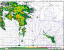
The HRRR (High Resolution Rapid Refresh) is handling it well so far. For reference here is what it was forecasting for 11AM

What Reed is referring to is how it is already getting linear which obviously still can produce severe weather but not the big supercells that they like/want.
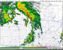
Here is 5PM. Notice the gap between the lines and how more cellular that second wave is at this point. This is where things could get interesting.

Link to current visible satellite showing the clearing getting into SW Iowa.

GOES-19 - Sector view: Upper Mississippi Valley - GeoColor - NOAA / NESDIS / STAR
Near real-time publication of GOES-East and GOES-West images from NOAA/NESDIS/STAR
Sooooo yes and no. The sun and instability really need to increase to get big supercells going. This first line is not going to be a main issue.
The HRRR (High Resolution Rapid Refresh) is handling it well so far. For reference here is what it was forecasting for 11AM
View attachment 127569
What Reed is referring to is how it is already getting linear which obviously still can produce severe weather but not the big supercells that they like/want.
Here is 5PM. Notice the gap between the lines and how more cellular that second wave is at this point. This is where things could get interesting.
View attachment 127570
Link to current visible satellite showing the clearing getting into SW Iowa.

GOES-19 - Sector view: Upper Mississippi Valley - GeoColor - NOAA / NESDIS / STAR
Near real-time publication of GOES-East and GOES-West images from NOAA/NESDIS/STARwww.star.nesdis.noaa.gov
ah I missed that this was a first round of sorts and the bigger threat was PM. Which makes more sense anyway. So there's time for clearing and heating yet. In addition to the **** already going down.
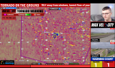
Tornado warning in Boone and Dallas County but none of the locals have cut in. strange
may be more afraid of the gray hairs calling in ******** about the Price is Right getting pre-empted.
Definitely a debris signature with that tornado. The low levels are hot in central
Iowa anything is possible today.
Iowa anything is possible today.
It's Young and the Restless now. Know your CBS morning lineup!may be more afraid of the gray hairs calling in ******** about the Price is Right getting pre-empted.


